


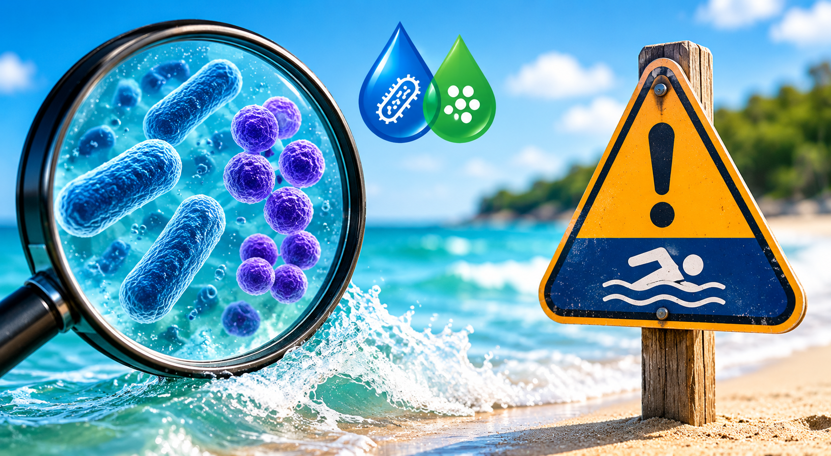
What E. coli and Enterococcus Results Actually Mean for Swimmers
When you get to the beach, you want to lay down your towel, put on sunscreen, and take your first swim of the day. But then you see a “Water Advisory” sign. You deserve a straight answer. You want to know if it is safe to swim in.
For testing beach waters, two common bacteria are E. coli and Enterococcus. Both bacteria inform health officials that water has been contaminated with feces. Yes, it’s gross, but there is no guesswork in the data. The bacteria count determines when swimming is safe and when staying out of the water is recommended.
What Is E. coli?
E. coli lives in the guts of people and animals. Most types are totally harmless. But high levels in water are a red flag. They signal that fecal waste found its way in. That waste can carry other harmful germs too. E. coli is basically a sign that something dirty got in.
Health officials test freshwater beaches, like lakes and rivers, for E. coli most often. High counts trigger advisories. Sometimes officials close the beach entirely until the numbers come back down.
What Is Enterococcus?
Enterococcus is another type of gut bacteria. Health agencies use it as their main test for ocean and saltwater beaches. It tracks swimming illness better than other bacterial tests do. So at a coastal beach, Enterococcus is the number driving any advisory you see posted.
Any Enterococcus level above 104 per 100 mL allows a local health department to issue a warning. The EPA sets longer-term standards as well. For a multiple-sample assessment, the average must remain below 30 per 100 mL. No single sample may exceed 110 per 100 mL. Hit those limits too many times, and a beach could face a longer-term closure.
Where Does the Bacteria Come From?
Fecal bacteria don’t appear out of thin air. Common sources include:
- Old or broken septic systems
- Sewage overflows after heavy rain
- Stormwater runoff carrying animal and pet waste
- Waterfowl, livestock, and animals near the shoreline
- Leaky diapers from small children in the water
Rain is a big trigger. After a heavy storm, waste washes off the land and straight into the water. That’s why advisories pop up so often the day after a big rain. Water can bounce back fast, but give it at least a day before you wade in.
Can It Actually Make You Sick?
It can, yes. But swallowing water is the real risk. Just splashing around carries much less danger. Some people face more risk than others. Kids, older adults, and anyone with a weak immune system should be extra careful around flagged water.
Health effects can include:
- Diarrhea
- Ear infections
- Skin rashes
- Respiratory issues
- Kidney damage in rare and serious cases
What About Fish?
Bacteria in the water does not harm fish or make them unsafe to eat. The fish are fine. Just clean, store, and cook your catch properly before eating it. That’s smart practice regardless.
How to Protect Yourself
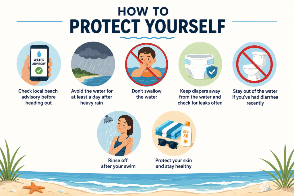
A few simple habits go a long way:
- Check your local beach advisory before heading out
- Avoid the water for at least a day after heavy rain
- Don’t swallow the water. Seriously.
- Keep diapers away from the water and check for leaks often
- Stay out of the water if you’ve had diarrhea recently
- Rinse off after your swim
These small steps can save you a rough few days with stomach trouble.
The Bottom Line
A beach advisory is not a warning that the water is gone for good. It is a short-term signal. The bacteria count is too high right now. The good news is that it usually does not last long. Levels often return to normal within a day or two. This can happen once the water clears after rain.
Most people never hear how common fecal bacteria is in swimming water. That is why one habit matters so much. Check local water quality reports before each visit. Now you know what the test results mean. You can make a smarter call before your next swim.
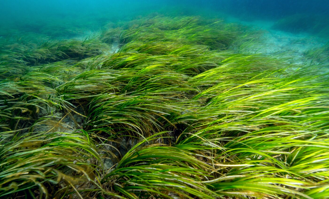
Eelgrass Meadows: The “Underwater Forests” That Protect the Bay
Most people miss it. Eelgrass meadows grow just below the water’s surface and do important work each day. Their subtle movements and contributions deserve more recognition. Eelgrass meadows are ocean secrets that deserve our appreciation.
What Exactly Is Eelgrass?
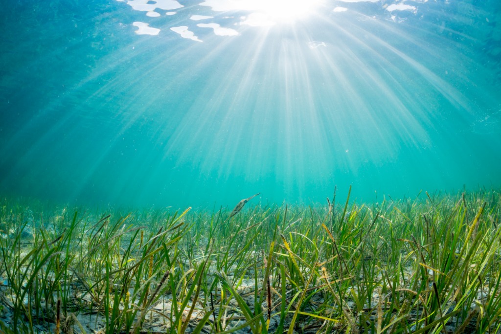
Eelgrass is not seaweed. But it is a flowering terrestrial plant that grows in the water. It is unlike most plants. Eelgrass anchors itself in the sea floor with its leafy stems and roots. In due time, eelgrass can fill submerged meadows. It spreads its lush greenery just below the surface.
Places like Coos, Yaquina, and Tillamook Bays in Oregon are nutrient dense and receive a lot of sunlight and are thus optimal locations for seagrass meadows to form.
Everything Lives in There
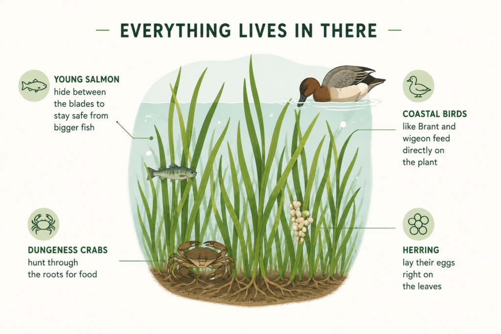
The eelgrass habitat acts like a nursery for sea life. All kinds of creatures depend on it:
- Young salmon hide between the blades to stay safe from bigger fish
- Dungeness crabs hunt through the roots for food
- Herring lay their eggs right on the leaves
- Coastal birds like Brant and wigeon feed directly on the plant
Eelgrass also cleans the water around it. It traps dirt and soaks up extra nutrients that would otherwise cause harmful algae blooms. A cleaner bay ecosystem benefits everyone from fishermen to families who swim there in summer.
It Fights Climate Change
Eelgrass stores carbon like a hardworking sponge. It pulls carbon dioxide out of the air. Then it traps that carbon deep in the mud beneath it. Scientists call this “blue carbon.” Coastal plants like eelgrass, mangroves, and tidal marshes store carbon at about three times the rate of land forests. Three times.
Eelgrass also helps keep the sea floor steady. Its roots hold the ground in place. Less erosion happens over time. Shorelines also get more protection from storm waves. So I see it as one plant with many jobs. It feeds wildlife. It cleans the water. It also shields the coast all at once.
The Threats Are Real
Eelgrass is disappearing fast. Pollution is a major cause. Coastal development is also harmful. Dredging can remove whole patches. Rising water temperatures can stress these meadows for long periods. Invasive species like the European green crab dig into the sea floor. Eelgrass beds are damaged and destroyed. In parts of Oregon, eelgrass cover has dropped by more than 80%. Around the world, we lose about two football fields of seagrass every single hour.
Oregon has also lost more than half of its total coastal habitat. That is a serious hit. Marine biodiversity is reduced. The bay ecosystem is thrown off balance. Many species depend on it.
Restoration Is Possible
Eelgrass can fully regenerate. In the Chesapeake Bay, restoration of seagrass led to 9,000 acres of eelgrass and also rebuilding the entire food web. In the Puget Sound, shoreline reinforcement worked in eelgrass bed rehabilitation. All of this is evidence of the success that eelgrass restoration can have when the effort is made.
There is a lot of room for improvement in the protection and restoration of marine meadows, and the same goes for the monitoring and the coordination. What remains needs to be protected now. What was lost can be restored.
Eelgrass meadows have served their purpose for a long time. It is time for us to do the same.
The Hidden Link Between Forests and Clean Water
Nature’s Water Filter
People usually admire forests because they contain diverse life forms and stunning beauty while their essential ability to purify water stays beneath the general awareness. Forests through their natural filtering action contribute substantially to preserving water quality that serves both wilderness and human settlements alongside all creatures. The water filtration process works through trees and forest soil which absorb rainwater before releasing it at a controlled pace into water reservoirs. The natural water filtration system results in constant clean water delivery while making water treatment facilities unnecessary. The amount of forested land in a watershed determines both the simplicity and affordability of water treatment systems therefore forests provide essential value for public health and municipal financial management.
Preventing Pollution and Erosion
Regulating the Water Cycle
The water cycle depends heavily on forests for its regulation process. The evapotranspiration process enables trees to extract soil water which then condenses into clouds that eventually form precipitation. The rainwater slows down when it passes through forest canopies which enables groundwater recharge through absorption. Through this process water supplies remain steady during dry times while heavy rain floods become less likely to occur. The stability of the water cycle declines after forest destruction causes the occurrence of more frequent droughts and floods and unpredictable rainfall patterns which affect agricultural production and water availability outside forest territories.
Economic and Environmental Benefits
Clean water depends on forest preservation since this connection exists both environmentally and economically. Forests in good condition lead to substantial reductions in the expenses cities and towns face during water treatment processes. Some municipalities have prevented the need for expensive filtration facilities by maintaining their forested watersheds and this has produced both financial and water quality benefits worth billions of dollars. The social value of forests expands because they enable recreational use as well as sustain fish stocks and retain wilderness habitats for different species.
The Cost of Deforestation
Forest clearing operations for agricultural and urban development purposes result in quick and major water quality deterioration. Water sources become contaminated through excessive runoff combined with soil degradation and water pollution which threaten both human drinking water and aquatic ecosystems. Communities become less secure against both flooding and drought conditions after forest loss because forest conservation acts as a vital strategy to ensure water safety.
Conclusion
Forests maintain a direct relationship with clean water resources. The environmental filtration mechanisms of forests work in unison with stabilized water systems to minimize pollution and management expenses which protect our fundamental water source. Forest conservation and restoration initiatives simultaneously protect nature and directly safeguard water quality for daily needs and healthy living in communities.

Watershed to Table: How Clean Water Sustains Local Food and Fisheries
The Lifeline of Local Food Systems
Every thriving fishery, together with a successful local food system, depends on clean water as its essential foundation. Water quality and availability, starting at high watershed elevations, determine crop productivity, livestock safety and sustainability, and aquatic life health. Rainwater that passes through healthy watersheds is filtered and stored as a dependable source for irrigation, livestock, and aquaculture. Community members achieve greater food security through high-quality watershed management practices that create better livelihoods and support lasting local economies.
Agriculture: Growing Food with Clean Water
Farmers require clean water for agricultural operations beyond crop and livestock hydration, as it enables them to produce safe, high-quality food products. The use of pure water in agricultural irrigation promotes beneficial plant growth and increased production while minimizing the risks of harmful substances and disease contamination. Contamination of water sources leads to crop contamination with harmful residues and waterborne diseases that affect livestock, threatening both food safety and public health. Maintaining forests alongside erosion prevention in watersheds produces clean water sources, leading to increased food production and secure food consumption.

Smallholder farmers specifically achieve advantages from well-managed watersheds. Watersheds store rainwater, providing drought protection during periods of water scarcity in various regions. Stable farming conditions enable both nutritious food for local family members and farmers to market additional yields, strengthening rural economies and advancing community health.
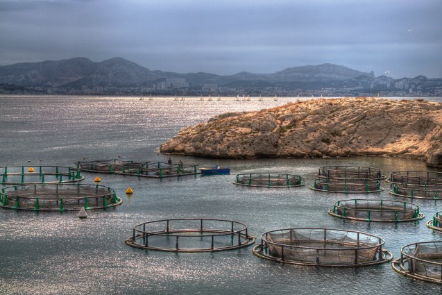
Fisheries: Clean Water, Healthy Harvests
The success of fisheries, together with aquaculture operations, depends entirely on water purity. Nurseries for commercially important fish and shellfish species occur in estuaries, rivers, and coastal bays. Clean water conditions help sustain high population levels in these environments, providing stable protein resources and income for residents. The combination of agricultural runoff and industrial waste, along with sewage pollution, leads to aquatic environments receiving excessive nutrients and heavy metals, and to contamination by pathogens, creating fisheries events that include harmful algal blooms and dead fish, as well as unsafe seafood contamination. The effort to keep pollution out of upstream watersheds remains essential to achieving safe seafood and healthy fisheries.
The Interconnectedness of Water, Food, and Community
The water cycle that leads food from its watershed to dining tables demonstrates how land depends on water for the benefit of human communities. Water quality is affected by food system operations, including crop farming, livestock breeding, and fish cultivation, creating a management challenge. Thorough implementation of sustainable watershed practices, with a focus on riparian buffers, reduced chemical use, and waste management, supports water quality maintenance for communal use.
Safeguarding the Future
The investment in clean water, along with healthy watersheds, develops into fundamental protection for food security alongside public health outcomes and targeted economic development. Protected watersheds will secure local food and fisheries sustainability in the coming years as climate change and population growth continue to intensify. The fundamental ingredient for maintaining our food supply and community strength runs from agricultural fields to fishing boats, thanks to clean water.

A Day in the Life of the Bay: Exploring the Natural Rhythms of Narragansett Waters
Tides: The Pulse of the Bay
From the first blush of sunrise over the calm surface to the hush of twilight as the moon rises, Narragansett Bay pulses with a rhythm set by the tides. The ocean waters experience a regular semi-diurnal cycle, generating two high tides and two low tides every 24 hours and 50 minutes. The gravitational forces of the moon and the sun generate a natural bay-wide timing system that controls every aspect of life in the bay.
The tide is at its lowest point during early-morning spring days, revealing the mudflats and rocky outcrops. The feeding grounds attract large numbers of shorebirds who use their bills to search for worms and shellfish that remain after the water has withdrawn. The bay continues flooding as the morning progresses, reaching its peak at high tide late morning. During high tide, the rising water level reaches four feet above low tide, submerging the flats and delivering new nutrients, along with plankton, to the estuary. Fish, along with crabs and other marine creatures, use the incoming waters to access fresh feeding grounds.
Sunlight, Moonlight, and the Changing Sky
The movement of sunlight throughout the day and changing light patterns function as essential elements that match the tidal cycle of the bay. The bay receives golden illumination from the early April sunrise, which begins at 5:45 AM, signaling the start of both wildlife and human activity. The water’s surface becomes a stage for fishermen and kayakers while gulls produce their initial calls during this time. The bay surface mirrors the changing sky as the sun reaches its peak.

The bay enters a calm state at 7:42 PM during the late April sunset period. The exposed sandbars and tidal pools during low tide attract crab seekers among children while families walk the shoreline. As the deepening dusk deepens, the moon emerges, showing either a slim crescent or a brilliant full form, creating a silvery pathway across the water. The combination of sunlight and moonlight serves as a navigational guide for tides and simultaneously controls the conduct of various ocean creatures, including fish spawn and night-flying birds.
The Tidal Clockwork and Its Influence
Narragansett Bay tides are monitored at various points throughout the waterbody, but each location shows minor differences in timing and height. The tidal range increases from 3.6 feet at the mouth of the bay to 4.6 feet at its head. The bay’s productivity depends entirely on this predictable water-level pattern, which serves as its fundamental operating force. The system experiences two daily water movements that distribute nutrients and oxygen and support tiny organisms, creating abundant food webs and healthy habitats.
Neap and spring tides occur every 14.8 days across the bay, which creates yet another natural rhythm for the bay to follow. Natural cycles control actions such as navigation and fishing, and determine when marsh plants grow and when shorebirds build nests.
Life in Sync with the Bay
People who spend time in the Narragansett Bay area naturally observe its recurring patterns. People must wait for the tides to determine suitable times for launching boats, as well as for shellfish harvesting and fishing. The habitats that support wildlife, along with the water-based recreational activities, exist because tides shape these coastal areas. The bay operates on its own natural time cycle, from sunrise to sunset and back, which reflects the ancient relationship between earth, water, and sky that shapes the daily experience of the Narragansett waters.

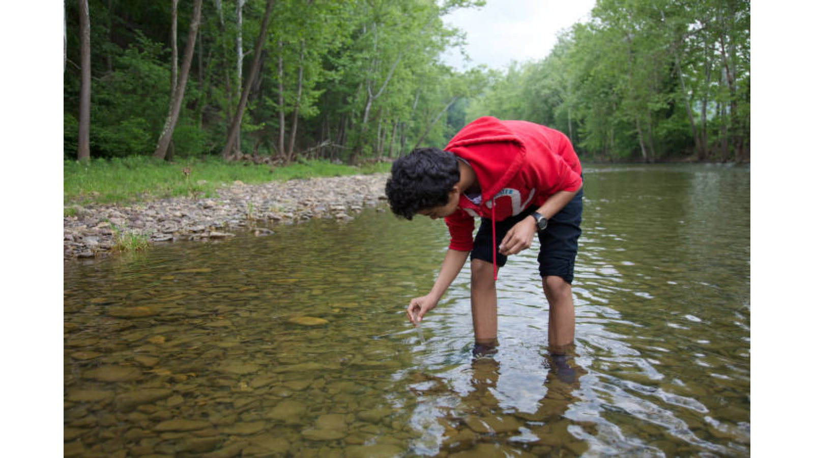
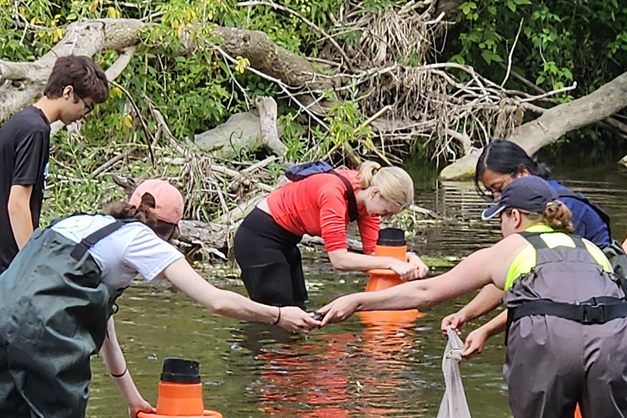
The Role of Citizen Science in Watershed Protection
Expanding the Reach of Water Monitoring
Daily citizens are reshaping watershed protection through their actions of gathering water-quality data and their ability to process and distribute this significant information. Government agencies, along with scientific experts, have traditionally managed water monitoring, but many streams, lakes, and rivers remain without testing due to resource constraints. The scientific involvement of citizens enables monitoring of local water bodies, significantly increasing the temporal and spatial coverage of water-quality data. Local community involvement enables scientists to assess water conditions across entire watershed areas, resulting in enhanced spatial and temporal water-monitoring data.
Detecting Pollution and Informing Action
The core benefit of citizen-science participation is the prompt identification of environmental hazards and their sources. Regular testing of water indicators, including dissolved oxygen, pH, temperature, and bacteria, allows volunteers to detect irregular changes, which leads them to report chemical spills and illegal dumping. The quick response capabilities of environmental authorities improve following timely reports from citizen scientists, thereby reducing negative effects on ecological systems and public health. Multiple observations from citizen scientists help authorities design more effective pollution mitigation approaches and identify pollution hotspots, enabling focused, efficient intervention.
Empowering Communities and Fostering Stewardship

Data collection through citizen science is only one aspect, as the initiative fundamentally depends on human participation. Participating communities in watershed monitoring lead to a better understanding of water quality problems, train participants in science, and develop their environmental protection habits. Understanding of the local environment increases when people from all walks of life participate in direct monitoring activities, turning them into protectors of their surroundings. The combination of ownership and responsibility leads people to maintain a lifelong dedication to water resource conservation and to develop common actions to protect these assets for future generations.
Enhancing Scientific Research and Policy
The information gathered by civilian scientists is essential for scientific analysis and further assists government decision-making. Widening citizen science sampling frequency and geographic coverage helps complete essential scientific data collection, verify satellite observations, and sustain monitoring analysis. Watershed management receives direction from these broad-ranging datasets, restoration efforts benefit from them, and pollution control performance is evaluated through them. When official monitoring programs integrate citizen science data, they significantly enhance their contributions to environmental policy development and resource management decisions.
Leveraging Technology and Collaboration

Modern technology has simplified the integration of mobile applications and user-friendly testing kits with online platforms, giving volunteers efficient tools to collect water-quality data that they can easily record and share. Training workshops, together with community-based programs, equip citizen scientists with the skills needed for high-quality data collection. Watershed protection through citizen science is more successful when formal collaboration among local organizations, academic institutions, and government agencies is in place.
Conclusion
Through citizen science, watershed protection becomes more effective by increasing monitoring capabilities, speeding up threat response, and fostering community environmental stewardship. Thankfully, citizen scientists serve as essential connectors between expert scientists and public participation, protecting watershed health and ensuring the availability of clean water for human populations, alongside wildlife and future inhabitants.

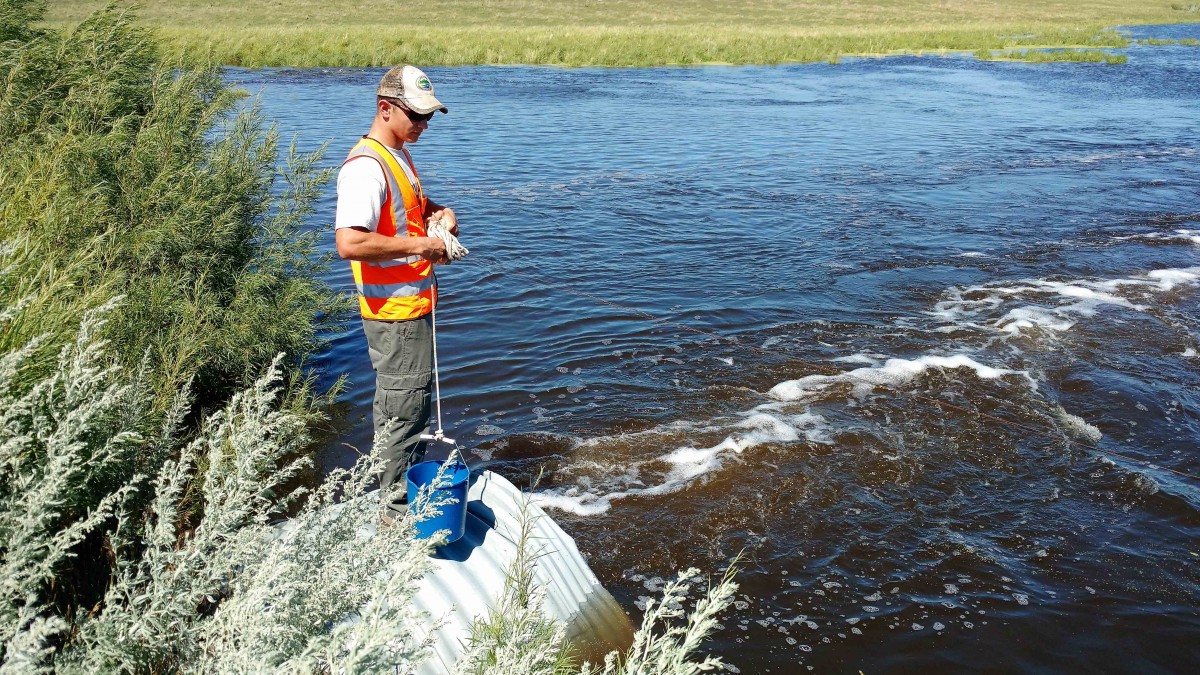
Recreation and Risk: The Science Behind Beach Closures
Coastal communities, together with their visitors, experience beach closures as familiar yet annoying events mainly during the summer season. Every beach closure results from scientific procedures that protect public health by detecting hidden water-based threats. The scientific processes behind beach closures demonstrate how officials manage recreation and safety risks through advancing technological methods for swimmer protection.
The main reason for beach closures is hazardous bacterial concentrations, primarily fecal indicator bacteria such as E. coli in freshwater and enterococci in saltwater. The bacteria act as indicators of whether harmful pathogens are present, which could lead to gastrointestinal illness, skin infections, or more severe diseases in people swimming. Throughout the bathing season, agencies regularly sample swimming areas to check for risks. Laboratories perform bacterial analyses on water samples obtained from specific locations and depths to maintain consistency after the samples reach them under controlled laboratory conditions.
The traditional bacteria culturing method demanded 18 to 24 hours to generate test results. The introduction of quantitative polymerase chain reaction (qPCR) as a molecular testing method now allows analysts to detect bacterial DNA within just a few hours. The new testing methods accelerate public health responses, thereby minimizing the time swimmers must remain exposed to unsafe conditions before beach closures take effect. The evaluation of water quality includes measuring physical parameters such as pH, turbidity, salinity, and dissolved oxygen, as well as bacterial counts.

The beach water quality can change rapidly due to rainfall, runoff, tides, and pollution incidents. The water can become contaminated when heavy rainfall washes away materials from roads, agricultural areas, and septic tanks, leading to sudden increases in bacterial levels. Multiple states, along with several nations, have implemented predictive systems to supplement their real-time testing practices due to variations in water quality. The predictive models leverage real-time rainfall and temperature data, along with historical bacterial records, to generate same-day advisories that help beach managers make proactive closure decisions. The U.S. Environmental Protection Agency (EPA) developed software tools and guidelines to support predictive modeling, and many regions now use them.
Sanitary surveys are a crucial tool that involves field investigations to identify pollution sources in watershed and shoreline areas. Managers can enhance long-term water quality by pinpointing and resolving identified pollution sources, allowing them to focus testing on sites and on remediation strategies.
The final step requires effective communication methods to achieve success. Most beach jurisdictions maintain real-time beach status notifications via online portals and mobile apps, along with posted advisories at beach locations. Public trust and safety depend on consistent advisory and closure standards, along with standard testing protocols and complete data transparency.
The practice of beach closures rests on scientific evidence collected throughout many years and modern technological advancements. Public health officials balance beach accessibility with illness risk by combining bacterial tracking with environmental monitoring and predictive modeling. The scientific methodology guarantees beaches are entirely safe for visitors to enjoy when they become accessible.

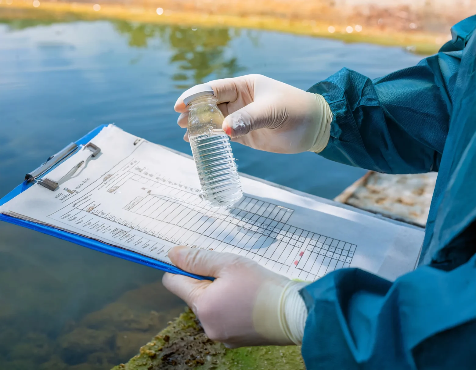
Beyond the Surface: What Water Quality Tests Really Tell Us
Unlocking the Story in Every Drop
The combined chemical and biological parameters in these tests enable a comprehensive assessment of water safety and ecosystem health. Water quality tests provide more than visual clarity inspections because they expose the concealed information about what water systems contain. The physical, chemical, and biological parameters combined in these tests enable comprehensive analysis of water safety, ecosystem health, and pollution control. Understanding the measurement criteria for water quality tests and their importance enables us to make better decisions regarding public health protection, environmental safety, and resource management.
The Three Pillars of Water Quality Testing
The framework for water quality testing consists of physical examination, chemical investigation, and biological assessment. Quick information on water contamination and usability emerges from physical tests that assess temperature and turbidity, as well as color and odor. High turbidity indicates soil erosion or runoff, whereas abnormal odors or colors reveal organic or chemical pollutants in the water. Physical signs usually detect water contamination before any other indicators emerge in waterways or supply systems.

The analysis using chemical tests provides detailed measurements of pH, dissolved oxygen (DO), total dissolved solids (TDS), nutrients (nitrate and phosphate), and heavy metals. Water quality assessment through these tests provides distinct insights into the water environment. pH affects both water taste and the survival rates of aquatic organisms, while DO sustains aquatic organisms; low DO readings indicate organic pollution or excessive waste. High TDS levels affect both drinking water taste and plumbing systems, while heavy metals such as lead and arsenic present significant health dangers to consumers. The detection of harmful agricultural runoff relies heavily on nutrient testing for nitrates and phosphates, as these substances trigger algal blooms and degrade aquatic ecosystems.
The examination of living organisms present in water forms the basis of biological testing. The detection of E. coli or coliform bacteria in water indicates contamination with sewage and animal waste, requiring immediate action to ensure safe drinking water. Scientists use aquatic insect diversity and algal counts to evaluate both ecosystem health and the overall environmental impact of pollution.
Interpreting the Results: More Than Just Numbers
Water quality test results gain their most important meaning through proper analysis. The laboratory compares test results with regulatory standards set by the World Health Organization and national environmental authorities. When water quality standards are surpassed, scientists trigger an immediate response that includes issuing water-boil alerts, facility upgrades, and source investigations. Multiple rounds of testing over time reveal patterns that demonstrate how water quality measures both positive and negative changes, as well as the impact of restoration programs. The extended data collection period is critical to watershed management, public health protection, and policy development.
The Bigger Picture: Safeguarding Health and Ecosystems
Water quality tests serve as essential protective measures to ensure the health and safety of people and natural systems. Community detection of imperceptible threats alongside safety standard compliance monitoring and pollution control measure evaluation is made possible through these testing methods. These tests reveal what remains unseen, allowing us to defend our essential resource of clean, safe water for future generations.
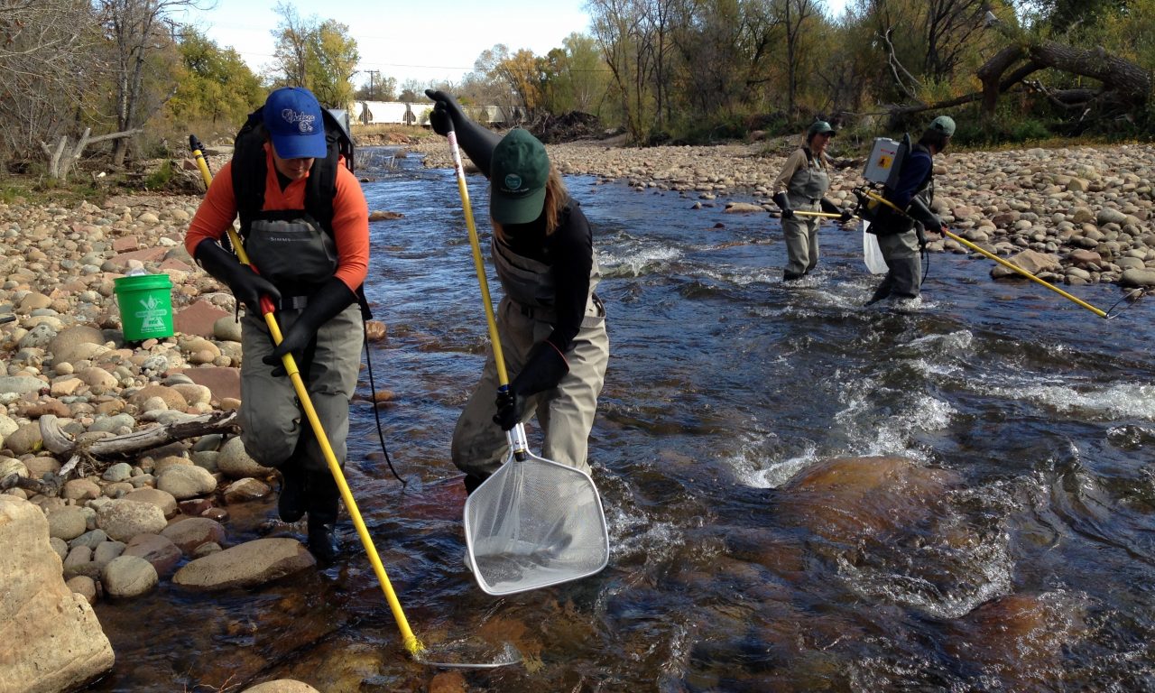
Monitoring Matters: How We Track the Health of Our Watershed
Why Monitoring Is Essential
Water resource management strictly depends on watershed monitoring programs. Scientific teams, together with resource managers, obtain relevant information on water quality, along with habitat data and biological community structures, to evaluate the condition of rivers and streams and surrounding territories. The collected data serve essential purposes, including detecting pollution sources, monitoring temporal changes, assessing restoration projects, and preserving water quality for human beings and wildlife populations.
What We Measure
A well-designed watershed monitoring system uses several indicators that, together, provide a precise understanding of watershed condition. These include:
Biological Indicators: The overall ecological condition is assessed through monitoring of fish, aquatic insects (benthic macroinvertebrates), algae, and aquatic plants. These organisms demonstrate the combined effects of pollution and habitat change because they integrate all water quality and quantity impacts across the watershed.
Chemical Indicators: Watershed conditions regarding pollutant types and concentrations become clearer when chemical tests are regularly conducted. Analysis of toxic substances in fish tissue through chemical testing provides information on the overall health of the ecosystem.
Physical Indicators: Stream measurements of temperature, flow rate, turbidity, dissolved oxygen, pH l, level, and other parameters provide essential information on water quality and its contributing stressors. The results of physical assessments reveal any variations stemming from climate events, land management practices, and environmental pollution.
Habitat Assessments: A healthy watershed base depends on assessing riparian vegetation, stream bank conditions, and in-stream habitat integrity. The analysis of habitats frequently reveals declines in biological communities that surface after chemical and physical measurements show normal results.
How We Monitor
The process of watershed monitoring requires both conventional methods and contemporary approaches. Regular field teams follow standardized protocols to measure physical parameters, collect biological specimens and water samples, and conduct habitat assessments. Technology has become indispensable for various purposes. The combination of sensor networks, remote sensing technology, and online monitoring equipment enables continuous data acquisition and rapid detection of pollution events. The combination of smartphone apps with wireless sensor networks has reduced the challenges of data collection and sharing, thereby increasing public engagement and transparency.
Designing Effective Monitoring Programs
To achieve successful watershed monitoring, one must undertake proper planning. Watershed monitoring programs adopt probabilistic sampling approaches to describe overall health conditions,s but focus their sampling on identified problematic locations or pollution points through targeted sampling. Monitoring different sub-watershed areas through rotating basin methods allows effective resource management and the detection of long-term patterns. Program decision-making for site selection, along with the adopted methods, depends on project objectives that include tracking restoration success, detecting threats, and meeting regulatory requirements.
Turning Data into Action
Monitoring provides knowledge for managing watersheds, through which restoration projects receive guidance, CE, and public participation occur. The process of monitoring allows us to make effective use of resources while establishing objective progress measurements by identifying trends, locating sources, and evaluating interventions. People who access public data on watershed health can mobilize to defend clean water, thereby contributing to environmental stewardship.
Conclusion
The continuously running multidisciplinary watershed health monitoring program integrates field activities with technological solutions and community involvement. We obtain vital knowledge to safeguard our water supplies through biological, chemical, physical, and habitat indicator tracking, benefiting present and future generations.

Open Space Matters: Saving Land to Save Water
The Crucial Connection Between Land and Water
Open spaces which include forests and wetlands and natural grasslands function as essential protectors of water purity. Multiple studies confirm that our land utilization patterns determine how well our water supply remains pure. The conservation of forests along with natural lands creates living water purification systems which collect rainwater then detain pollutants before gradually distributing clean water into waterways and groundwater. Water quality deteriorates while runoff intensifies and water treatment costs together with flood management expenses surge substantially when these lands are converted for development or agricultural purposes.
Forests: Nature’s Water Purifiers

Water protection depends heavily on forests for its preservation. Research findings show that water which passes through forested zones emerges as cleaner than water that flows through urban or agricultural areas. Riparian buffers which are forests located near streams and rivers demonstrate exceptional capability to eliminate nitrogen and sediment pollutants before they enter the water. The streams maintain their cleanliness and health when forest cover remains above 70% while nitrogen levels in streams increase when forest cover falls below 66%. The preservation and restoration of wooded land bases water quality enhancement along with protection of aquatic habitats and biodiversity maintenance.
Economic Benefits of Land Conservation

The decision to protect open spaces delivers both environmental benefits along with sound economic advantages. Research in the Delaware River Watershed demonstrated that forest land protection of 21,000 acres prevented stormwater infrastructure expenses approaching $57 million which would have exceeded maintenance expenses by $6 million and the original conservation expense by more than three times. Communities that ban development on these lands achieve dual benefits of reduced water treatment expenses and flood control costs and maintain clean water availability for millions of people.
Buffer Zones and Catchment Management
Water quality management benefits from the protection of unfragmented natural vegetation which should be maintained both in riparian zones and throughout entire catchment areas. Natural buffers work to stop and clean surface runoff and control soil erosion and regulate water temperatures which are vital for maintaining healthy freshwater environments. The wider and more intact the buffer, the greater its protective benefits. Degrated land transformation into natural vegetation systems creates additional pollutant filtering capabilities which stabilize water flow patterns particularly when faced with intense storms or drought conditions.
The Cost of Losing Open Space

Natural lands that turn into roads and rooftops result in heavier stormwater runoff that simultaneously brings more pollutants into streams while breaking down the water cycle mechanisms. The situation causes additional flooding events along with stream bank erosion which destroys wildlife habitats and diminishes the rate of groundwater recharge. Multiple effects add up to polluted water bodies and increased treatment expenses together with heightened sensitivity to climate stress.
A Call to Protect What Matters
The protection of open space represents an optimal method to secure water quality throughout present and developing generations. Communities that focus on land conservation particularly forests and riparian buffers will obtain cleaner water supplies together with improved ecosystems while achieving financial savings. The pressing situation now demands open space protection since land conservation equals water conservation.